High spatial resolution sea surface temperature (SST) observations are of great importance for the understanding and modeling of air-sea coupling, ocean dynamics in fronts, upwelling zones, current separation zones, and coasts. Although polar satellite instruments and geostationary satellite instruments can retrieve SSTs in cloudy conditions, microwave sensors have lower spatial resolutions of 25 km. The satellite spatial scales can resolve large-scale patterns, but the fine structure and the underlying filamentous structure of ocean temperature fields are not resolvable with these instruments. All of these platforms suffer from land contamination of coastal pixels due to the complexity of coastlines, which, in some cases, makes it impossible to retrieve SST in upper regions of estuaries and fjords.
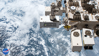
The ECOsystem Spaceborne Thermal Radiometer Experiment on Space Station (ECOSTRESS) push-whisk thermal radiometer on the International Space Station provides the highest spatial resolution temperature retrievals over the ocean that are currently available. It was launched on 29 June 2018, and the first scenes were retrieved on 29 July 2018. However, the accuracy and stability of the SST observed by the ECOSTRESS have not been fully characterized.

In their new study titled "Characterization and Validation of ECOSTRESS Sea Surface Temperature Measurements at 70 m Spatial Scale", Professors David Wethey and Sarah Woodin, and their colleagues Dr. Jorge Vazquez-Cuervo (California Institute of Technology) and Dr. Nicolás Weidberg (former post-doc in the Wethey lab, now Assistant Professor at the Universidad de Oviedo) used radiance transfer simulations and triple collocations with in situ ocean observations and NOAA L2P geostationary satellite ocean temperature retrievals to characterize brightness temperature biases and their sources in ECOSTRESS Collection 1 (software Build 6) data for the period 12 January 2019 to 31 October 2022. They found that the ECOSTRESS Collection 1 Level-2 surface temperature product (2018–present) has a ~1 °K cold bias relative to VIIRS observations and to in situ observations on lakes, coastal waters , and the ocean. Data also indicate that the spatial and temporal radiometric noise levels of ECOSTRESS and the planned instruments are higher than in current operational SST instruments. It will therefore be necessary to develop calibration methods that reduce the brightness temperature biases and reduce the detector to detector differences in sensitivity for creating a sea surface temperature product that meets the requirements of the SST community.