Center of GIScience and Geospatial Big Data (CeGIS) has access to a variety of resources
including drones, spatial computing cluster, GIS and statistical software tools, and
big data platform that enable geospatial data collection, processing, analysis, and
visualization. Our computer labs and meeting spaces offer an interactive and collaborative
learning environment.
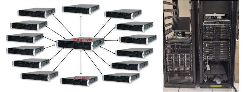
High-Performance Big Data Computing Cluster
CeGIS has access to a high-performance big data computing cluster (supercomputer)
named GeoRapider, serving as a testbed for geospatial big data analytics and computing
intensive research and applications. GeoRapider consists of 15 computer servers with
a total of 232 CPU cores, 864GB memory, and 200 TB of storage. This supercomputer
is established by Dr. Zhenlong Li and housed in Sumwalt building at UofSC. It is maintained
by the GIBD lab and UofSC Research Computing in the Division of Information Technology.
The center is also equipped with Deep Learning Workstations powered by high-end NVIDIA
Titan XP GPUs for geospatial Artificial Intelligence (GeoAI) research and development.
Left: Logic view of the GeoRapider supercomputer (1 master node, 14 work nodes); Right:
Physical view of the GeoRapider located in the Sumwalt server room at UofSC
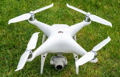
sUAS technologies for near-surface 3D mapping
Phantom 4 drone
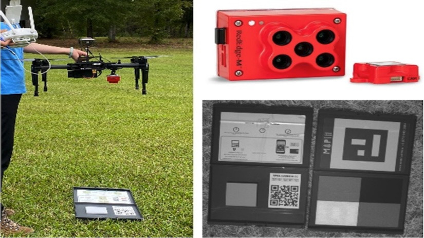
CeGIS has access to a number of drones and field instruments for supporting near-surface
coastal mapping and research, including : 1) two Phantom 4 with payload of true-color
cameras and one Matrice 100 with a multi- spectral sensor (RedEdge-M) for 3-D landscape
surveys; 2) survey-grade (cm level) GNSS unit (Emlid Base+Rover bundle); 3) a handheld
field Spectrometer (Ocean Insight) to collect field spectra in 350-1000nm and; 4)
a 25-seat Pix4D software package for drone data analysis in our computer labs. Partner
programs such as the ESRI-SC also maintain heavy lift drones (e.g., Matrice 600) for
integrated projects.
Matrice 100 mounted with a five-band sensor (MicaSense RedEdge-M) and a built-in calibration
panel.
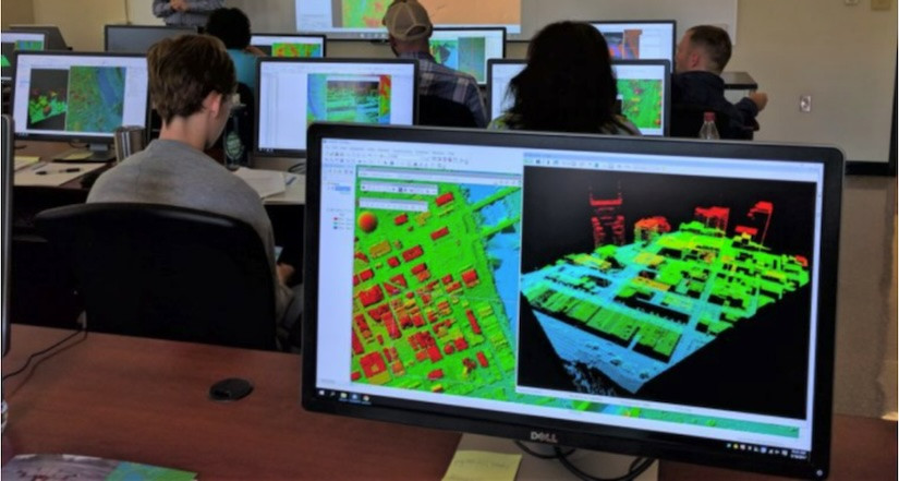
GIS Software and Computer Labs
The Department of Geography at USC is among the top geography programs in the nation
with strong GIScience research. CeGIS has access to the departmental resources, including
two modern GIS computer labs with 70 high- end desktop computers equipped with the
latest GIS, remote sensing, spatial analysis, computing and statistical software tools
such as the ESRI and ERDAS suite of GIS packages and special-purpose software tools
for hyperspectral remote sensing, LiDAR data processing, and visualization.
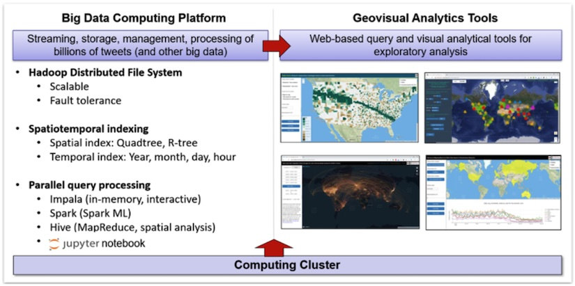
Geospatial Big Data Computing Platform
On top of our big data computing cluster, we developed a Geospatial Big Data computing
platform powered by Hadoop, Spark and Impala with a set of innovative parallel processing
algorithms, spatiotemporal indices, query analytical tools, and interactive web portals
to efficiently manage, analyze and visualize tens of billions of geotagged tweets,
terabytes of climate data, and other big data such as mobile location data, taxi trip
data, and electronic health records. For example, using the platform, massive tweets
can be queried, extracted, and visualized within seconds based on the criteria of
spatial regions, keywords, time period, and spatial resolutions.
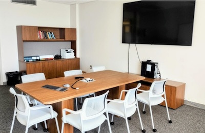
Conference Room
CeGIS is equipped with a modern conference room with a large TV display for video
conferencing and presentations and an interactive big data visualization station.
Challenge the conventional. Create the exceptional. No Limits.